
Hiking and camping in Tyresta National Park
This past weekend my girlfriend and I went out for an overnight camping and hiking trip to Tyresta National Park just south of Stockholm. If you’re into the outdoors, this is definitely a great place to begin checking out nature in Sweden! I’ve been loving the easy access to parks and natural areas all throughout Stockholm, but it just doesn’t compare to truly getting out into the middle of nowhere.
(updates – I’ve started creating separate posts for other trips to Tyresta, and to Björnö Naturreservat.)


Trail difficulty
If you’re new to hiking (like I very much am) I’d recommend stepping up your cardio training at least a bit before taking the route that we did. My girlfriend insists that it’s an easy trail by Swedish standards, but my American definition of a “trail” must be slightly different.

You won’t be doing any actual climbing, but do be prepared to find alternate routes around fallen trees and rocks. Shoes with a decent grip are a must because you will be walking up and down very smooth, slanted sections of stone. Before it starts to sound like I’m complaining too much, it was absolutely worth the views, and the variety of different terrain kept things interesting until we got to our campsite.
Because we’re both super nerds, we made sure to log Fitbit data of the route to and from our campsite. The trails in Tyresta are extremely well marked out aside from a few spots were we really had to keep an eye out for tree markings, and there was only once we had to go old school and get a compass out to make sure we were heading the right way. On this trip we were trying to get further out into nature than usual, but for day trips there are plenty of super easy smooth trails to just get out and enjoy the scenery.

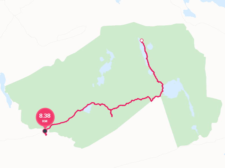
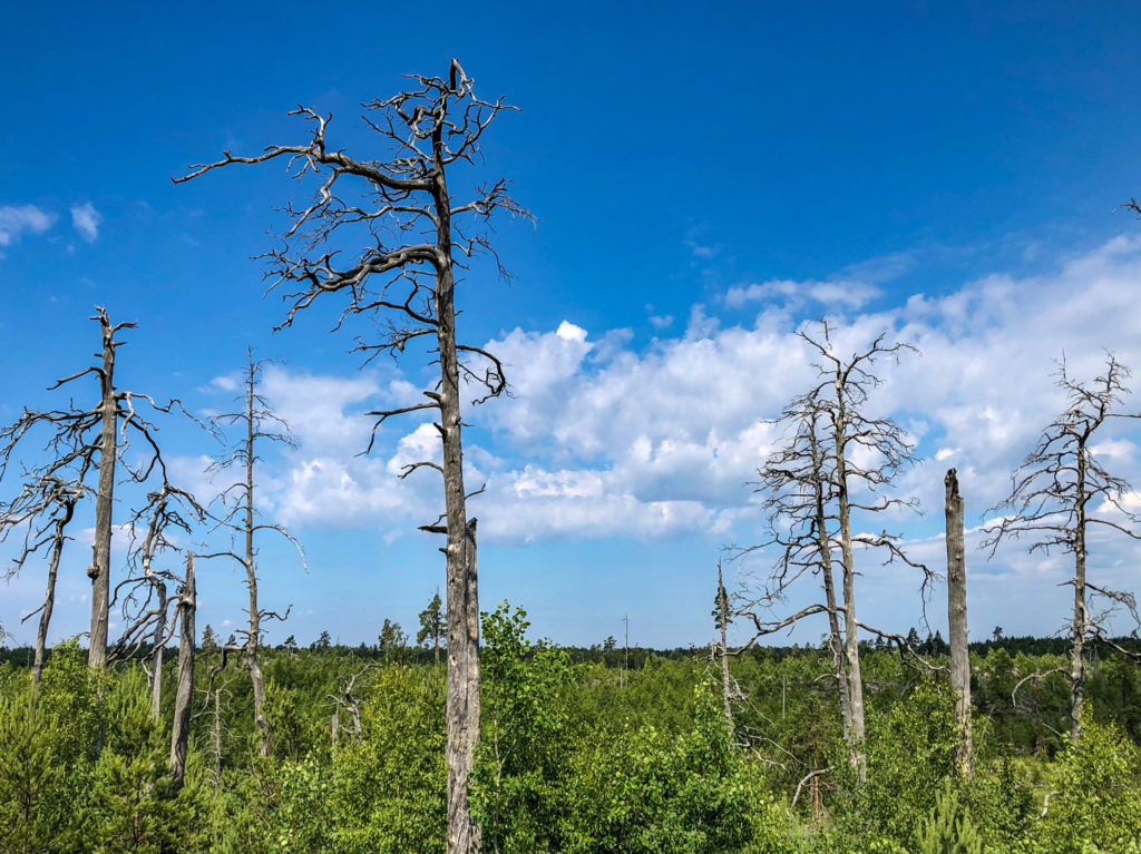
Still very beautiful, and goes through an area of new growth from a forest fire back in 1999.
Notable Views
There were almost too many interesting things to describe in detail here. Next time I’d love to go back with a better camera and spend a day or two just exploring. I’m not quite used to nature in Sweden being so accessible and overall friendlier than back in the US. In Michigan I considered nature fairly tame, but you still had to watch out for poison ivy, poison oak, various snakes and spiders, bears, wolves, coyotes, etc. Here there is one semi-dangerous snake, ticks, and… that’s about it as long as you don’t eat anything weird. It gets a bit wilder up north, but we’ll start exploring that later on.
Your photographs are postcard quality! I look forward to many more posts from your adventures!
Thanks a lot for the information on both Tyresta and Björnö =)